
La Nicolière Viewpoint – Complete Visitor Guide
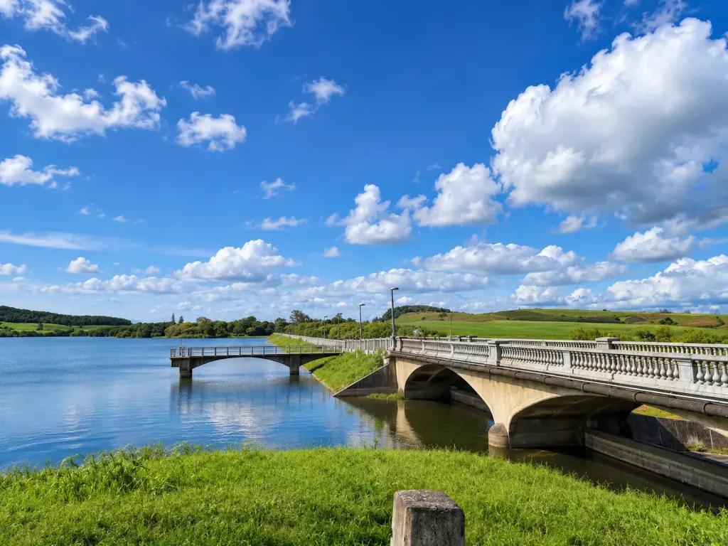
La Nicolière Viewpoint is one of the quieter scenic stops in northern Mauritius. Instead of beaches and lagoons, you’ll find a large freshwater reservoir surrounded by forested hills, sugarcane fields and winding country roads. On a clear day, the view stretches across the northern plains towards the coast, making it a good place to stop for photographs or simply enjoy a different side of the island.
Located near Grande Rosalie in the Pamplemousses district, La Nicolière is especially worth considering if you’re travelling through the north by car. The drive passes through green countryside, with sections shaded by tall trees, before reaching the reservoir and its roadside viewpoints.
There isn’t a ticket office, restaurant or organised tourist attraction here. Most people come for the scenery, a short break during a drive or a quiet moment overlooking the water. There are also walking paths in the surrounding area, although these are quite different from the maintained trails found in national parks.
This guide covers where to find La Nicolière Viewpoint, what you’ll see, the history of the reservoir, the best time to visit and a few practical things worth knowing before setting off.
La Nicolière Viewpoint at a Glance
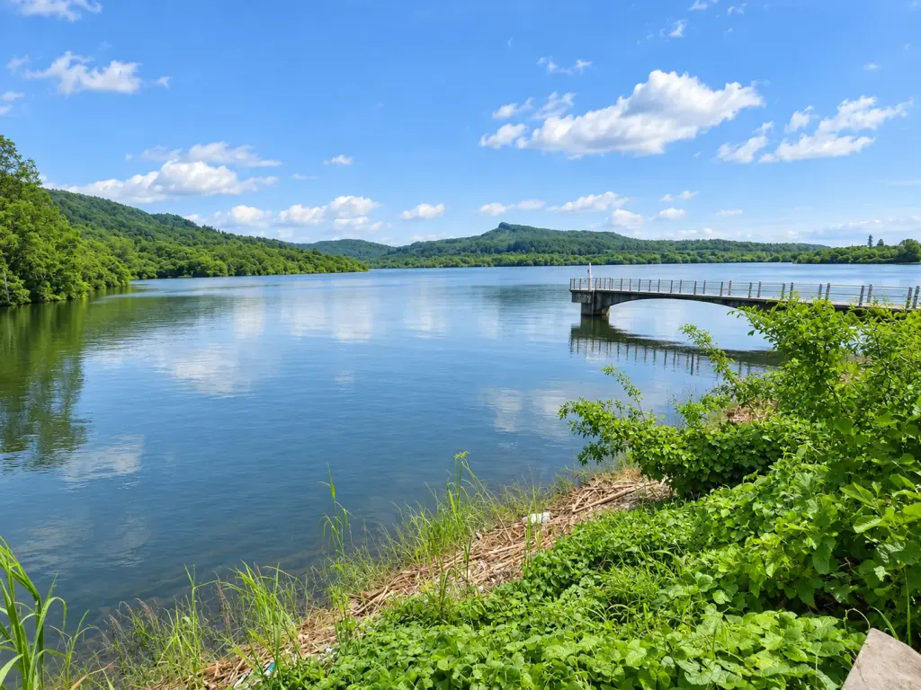
La Nicolière is a freshwater reservoir in the northern interior of Mauritius, with several places along the surrounding roads where you can enjoy views over the water. The best-known roadside viewpoint is on the B49, near Grande Rosalie.
The reservoir is an important part of the island’s water-supply infrastructure. It provides water for domestic, agricultural and industrial use, serving northern Mauritius and part of Port Louis. What makes it interesting for visitors is the contrast between the reservoir, the wooded hills and the open landscape stretching north towards the coast.
| Location | B49 road, near Grande Rosalie, northern Mauritius |
| District | Pamplemousses |
| Entrance fee | No admission fee for the roadside viewpoint |
| Opening hours | No staffed entrance or formal ticketing hours; visit during daylight |
| Parking | Small informal roadside stopping areas |
| Facilities | Do not rely on finding toilets, shops or food vendors at the viewpoint |
| Time to allow | About 15–30 minutes for a short scenic stop |
| Best for | Photography, scenic drives and quiet countryside views |
If you’re expecting a large observation deck with a café, souvenir shops and designated walking routes, La Nicolière isn’t that kind of attraction. It is better approached as a short countryside stop. You can spend a few minutes enjoying the view, take photographs and continue your drive without needing to plan half a day around it.
There is also a difference between the La Nicolière Viewpoint and the wider La Nicolière Reservoir. The first generally refers to the roadside stopping area with panoramic views. The reservoir itself covers a much larger area, with a dam, feeder canal and surrounding woodland. Not every part of the reservoir is intended for public access.
Where Is La Nicolière Viewpoint and How Do You Get There?
La Nicolière Viewpoint is located along the B49 road near Grande Rosalie, inland from the busy coastal towns of northern Mauritius. The road runs through an area of sugarcane fields, forested slopes and small settlements, making the journey part of the experience.
By car: Driving is the most practical option. If you’re coming from Grand Baie, Grand Gaube or another part of the north, use a navigation app to find La Nicolière Viewpoint rather than simply searching for the reservoir. From Port Louis, follow your navigation route towards the northern interior and Grande Rosalie.
As you approach the reservoir, expect narrower roads and bends, particularly in the wooded sections. The scenery can be distracting, so leave the photographs until you have found somewhere safe to stop. Watch for oncoming vehicles around blind corners and avoid parking where you would obstruct traffic.
There are small roadside parking areas and informal lay-bys near the viewpoint. These are not the same as a large, managed tourist car park. If the stopping area is full, don’t leave your vehicle on a bend or block the road. Continue until you can turn around or find another suitable place.
By taxi or private driver: This is a convenient alternative if you’re visiting without a rental car. Ask the driver to take you to La Nicolière Viewpoint on the B49 and agree on the fare and return arrangements beforehand. Because the area has limited services, it is better to keep the same driver for the visit or arrange a confirmed pickup.
By bus: Public transport isn’t particularly convenient for reaching the actual viewpoint. Buses serve villages in the surrounding region, but you should not assume there is a regular service stopping directly at the viewing area. Walking along narrow country roads without a proper footpath is not a good option, particularly with children.
Google Maps: View La Nicolière Viewpoint and get directions.
If you’re exploring the northern part of Mauritius by car, La Nicolière can be combined with other inland attractions, including the Sir Seewoosagur Ramgoolam Botanical Garden in Pamplemousses or L’Aventure du Sucre. They offer a different experience from the viewpoint, particularly if you want to spend more time learning about the island’s plants and history.
For general driving advice, including road conditions and local rules, see our driving in Mauritius guide.
What to Expect at La Nicolière Viewpoint
The main reason to visit La Nicolière is the view. From the roadside viewpoint, the reservoir stretches across the valley, with green hills rising behind the water and sugarcane fields extending towards the northern plains. On a clear day, you may also see the distant coastline and islands offshore, including the distinctive outline of Coin de Mire from some positions.
The scenery changes with the weather and water level. When the reservoir is relatively full, the water can reflect the surrounding hills and clouds. During drier periods, more of the exposed banks may be visible, giving the landscape a different appearance. Don’t expect the water to look exactly like photographs taken after a period of heavy rain.
There is no need to follow a long walking trail to appreciate the main viewpoint. The attraction is essentially the panorama itself. Many visitors stop for a few photographs, enjoy the fresh air and continue towards their next destination.
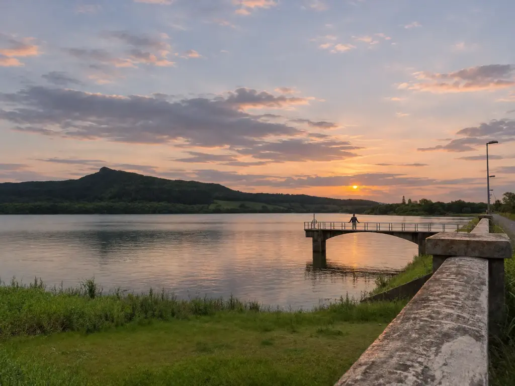
Photography: The contrast between the lake, trees and distant landscape makes La Nicolière particularly interesting for wide landscape photographs. Early morning can provide clear views and soft light, while late afternoon often creates warmer colours across the hills. If you’re using a phone camera, try including some of the surrounding trees or the curve of the road to give the picture more depth.
Cloudy weather can be attractive too. Low clouds sometimes settle around the hills, and the greenery can look especially rich after rain. However, heavy mist may hide the wider view, and wet roadside surfaces can make stopping or walking more difficult.
The area is generally much quieter than Mauritius’ major tourist attractions, although weekends and public holidays can attract more visitors. It is also a place used by local residents for short drives and informal outings, so don’t assume you’ll have the viewpoint to yourself.
One thing to keep in mind is that La Nicolière is a working reservoir, not a recreational lake. There are no organised swimming areas, lifeguards or water-sport facilities at the viewpoint. It is best enjoyed from the roadside viewing areas rather than attempting to enter the water or access restricted infrastructure.
The History of La Nicolière Reservoir
La Nicolière has a history that goes back well before the construction of the reservoir. The area’s name is associated with André Refuveuil, a French landowner known by the nickname Nicolière during the eighteenth century. The surrounding land later formed part of the wider agricultural landscape of colonial Mauritius, including sugar estates and mills.
A sugar mill once operated in the area, with the last mill reported to have ceased production following a fire in 1838. By the early twentieth century, the land had attracted the attention of government engineers looking to improve water storage and distribution.
The government purchased land in the area in 1915, and reservoir construction work began during the following years. La Nicolière Reservoir was completed in 1929, with a dam built across the Rivière du Rempart near Grande Rosalie. Its purpose was to provide a more reliable water supply for domestic, industrial and agricultural needs, particularly in northern Mauritius and part of Port Louis.
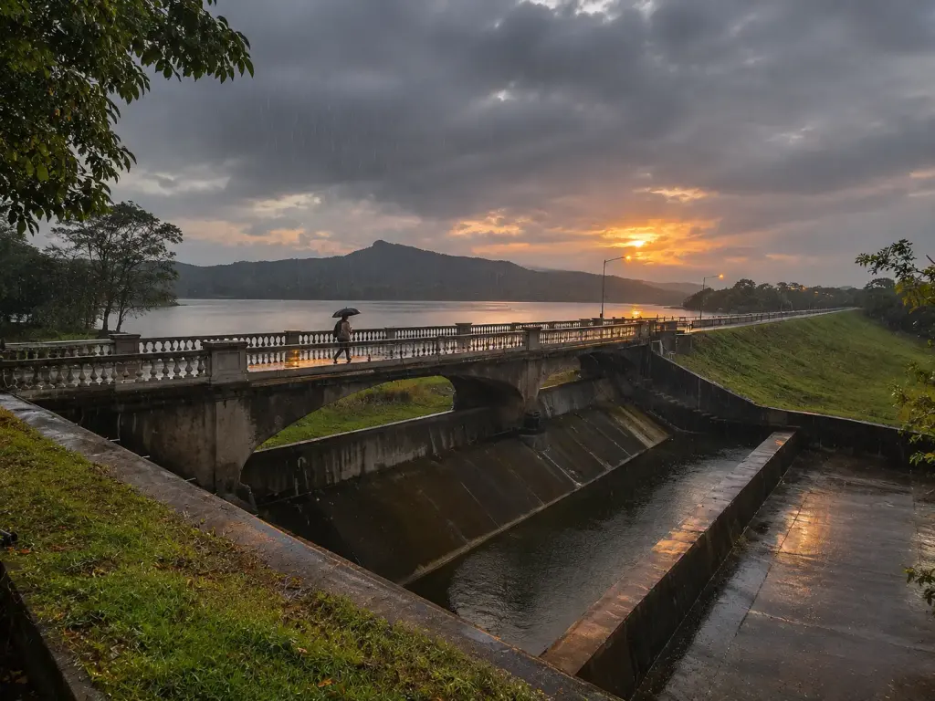
Although the reservoir looks like a natural lake from a distance, it is part of a carefully planned water-supply system. Its recorded storage capacity is approximately 5.26 million cubic metres, a figure established following a hydrographic survey in 1996.
One important part of this system is the La Nicolière Feeder Canal, constructed in 1929. The canal extends for approximately 27 kilometres and helps transfer water into the reservoir’s supply network.
In December 2002, the Midlands Dam was completed further south. It acts as a buffer reservoir, supplementing the water available to La Nicolière. Water released from Midlands connects to the Grand River South East and the feeder canal system. This significantly increased the amount of water that could be supplied through the network each year.
The difference between storage capacity and annual water supply is worth understanding. La Nicolière can store approximately 5.26 million cubic metres at a time, but water is continuously supplied, released and replenished. With the Midlands connection, the system’s regulated annual yield increased from approximately 30 million to 71 million cubic metres. These are two different measurements, not conflicting figures.
Another historical feature is the bridge associated with Paul Le Juge de Segrais, a Mauritian engineer who worked in the country’s public works administration. The bridge carries his name and forms part of the area’s infrastructure heritage. When exploring the reservoir, remember that the bridges and dam structures have practical functions, so avoid stopping on traffic lanes or entering areas where access is restricted.
La Nicolière remains important to the northern water-supply network. Proposals to increase its storage capacity were still being examined in 2026, although no construction timetable had been confirmed. For more technical information about the reservoir, its capacity and its connection to Midlands Dam, visit the Mauritius Water Resources Unit.
Walking Trails, Wildlife and Nature Around La Nicolière
The forested hills and waterways around La Nicolière attract people who enjoy walking, fishing, photography and spending time outdoors. However, the main viewpoint should not be confused with a developed hiking attraction. Some of the nearby paths are informal, can be difficult to follow and may pass close to canals, steep banks or working infrastructure.
One of the better-known walks follows sections of the La Nicolière Feeder Canal. Local hiking routes describe a walk of roughly four kilometres return, taking approximately one and a half to two hours. The route passes through green vegetation and includes sections that can become muddy after rainfall.
Some walkers continue towards the small bridge commonly called Pont Jamblon. This bridge has been described as poorly maintained, with incomplete railings, and it should not be treated as a safe crossing. If you choose to explore the canal area, use reliable local route information, stay away from exposed edges and never cross a damaged structure simply to complete a walk.
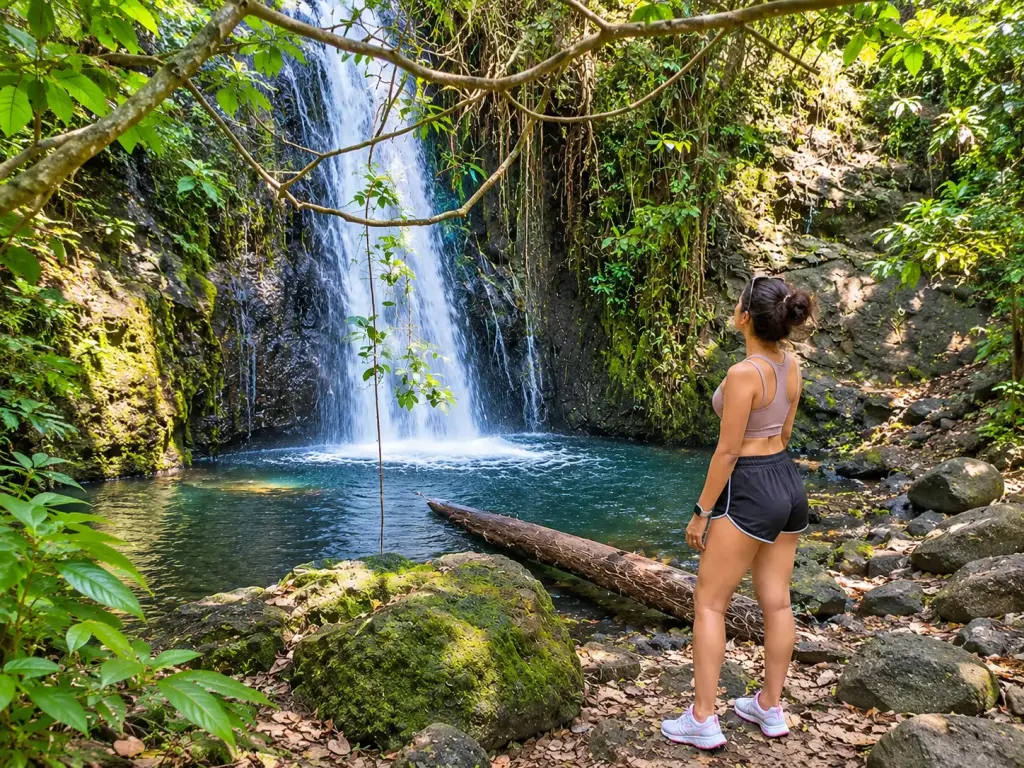
There are also small streams and seasonal cascades in the surrounding hills. Their appearance can change considerably depending on recent rainfall. They aren’t necessarily accessible by a marked public trail, and following a stream into dense vegetation or towards a power station is not a sensible activity without appropriate local knowledge and permission.
Wildlife: You may encounter long-tailed macaques around the wooded roads and reservoir area. These monkeys are accustomed to human activity in many parts of Mauritius, but they remain wild animals. Keep food secured, don’t feed them and give them space, particularly if there are young monkeys nearby.
Birds are another reason to pay attention to the surroundings. Common species such as mynas, bulbuls and other woodland birds can be seen or heard around the trees. At certain times of day, you may also notice Mauritius fruit bats flying above the vegetation. Wildlife sightings depend on the weather, time and location, so they’re a possibility rather than something guaranteed on every visit.
The vegetation around La Nicolière includes a mixture of introduced and native plants. Tall trees create shaded sections along the road, while guava bushes and other dense growth cover parts of the surrounding hills. During the Chinese guava season, generally in the cooler months, these areas can attract people collecting goyaves de Chine. Picking fruit and walking through woodland should only be done where access is permitted.
If you’re primarily interested in hiking rather than taking photographs, a properly planned trail elsewhere on the island may be more suitable. Our guide to the best hikes in Mauritius covers routes for different experience levels.
Best Time to Visit and Practical Tips
La Nicolière Viewpoint can be visited throughout the year, but the experience changes depending on the weather, visibility and water level. Unlike a beach destination, you don’t necessarily need perfectly clear skies to enjoy the scenery. A little cloud cover can make the surrounding hills look particularly attractive.
Early morning: A good choice for photography and clear views across the northern plains. The light is generally softer, temperatures can be more comfortable and the roads may be quieter than later in the day.
Late afternoon: Another good time for photographs, especially when warm light falls across the reservoir and surrounding hills. Make sure you leave enough daylight to return safely, particularly if you’re unfamiliar with the winding roads.
Summer (November to April): The vegetation is often green and the reservoir may receive more rainfall, although water levels depend on the wider supply system and seasonal conditions. Summer can also bring heavy showers and thunderstorms, so avoid exposed areas during bad weather.
Winter (May to October): Temperatures are usually more comfortable for countryside outings, especially around the hills. The reservoir level may be lower during drier periods, revealing more of the banks. Rainfall patterns vary between years, so it’s best not to assume that the reservoir will always be full in summer or low in winter.
Before setting off, keep these practical points in mind:
- Bring water and snacks: There are no dependable food or drink vendors at the roadside viewpoint.
- Plan your toilet stop: Don’t count on finding public toilets at the viewpoint. Use facilities in a nearby town before heading into the reservoir area.
- Park carefully: Use a safe roadside stopping area and avoid blocking traffic, especially around bends.
- Wear suitable shoes: Ordinary footwear is fine for a brief roadside stop, but closed shoes with good grip are preferable if you intend to walk on uneven or muddy ground.
- Keep away from the water’s edge: Some banks are steep, muddy or slippery. This is a working water-supply reservoir, not a designated swimming location.
- Don’t feed the monkeys: Keep food inside your bag or vehicle and avoid approaching wild animals.
- Take your rubbish home: Litter has been a recurring problem around the reservoir. Bring a bag for your waste rather than expecting bins to be available.
- Check the weather: Heavy rain, poor visibility and thunderstorms can make the narrow roads and informal trails less safe. Use the Mauritius Meteorological Services for current forecasts and warnings.
Is La Nicolière Viewpoint worth visiting? Yes, particularly if you’re staying in northern Mauritius or planning a scenic drive through the countryside. It’s a pleasant change from the coast and doesn’t require an entrance ticket or a long walk. The most enjoyable part is often the drive and the panoramic view rather than an extensive list of activities at the destination.
Is it suitable for children? Families can enjoy a short roadside stop, but children need close supervision near the road, barriers and steep banks. There are no organised children’s facilities, and you shouldn’t treat the reservoir as a safe place for swimming or water play.
Can you have a picnic? A small snack or brief break at a safe roadside stopping area is more practical than planning a large picnic beside the reservoir. Respect any local restrictions, avoid blocking access and don’t drive onto exposed reservoir banks. The water is used to supply communities, so keeping the area clean is especially important.
For anyone who has mainly explored Mauritius’ beaches and coastal towns, La Nicolière offers a different view of the island. The reservoir, surrounding greenery and winding country roads make it a worthwhile short stop, particularly when combined with a relaxed drive through the north.
If you enjoy places that are less developed than the main tourist attractions, you’ll find more ideas in our guide to hidden gems in Mauritius.
Was this guide useful?
Tours and activities in the north
Hand-picked from GetYourGuide. Free cancellation on most bookings.
Some links on this page are affiliate links. If you book through them we may earn a small commission, at no extra cost to you. It helps keep Creole Mauritius free.

Questions and tips