If you think Mauritius is nothing but manicured lawns, infinity pools, and cocktails with little umbrellas, you clearly haven’t been to the southeast coast. Sitting about five kilometers off the shore of Mahebourg, in the choppy embrace of the Grand Port Bay, lies a jagged piece of coral rock that looks like the set of a dramatic period drama waiting for a director to yell “Action!”
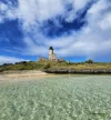
This is Île au Phare (officially known as Île aux Fouquets and locally referred to as Lighthouse Island). It is where history, nature, and the relentless Indian Ocean crash into each other, literally and metaphorically. It’s wild, it’s windswept, and it’s one of the few places on Earth where you can stand inside a crumbling 19th-century ruin while watching massive waves try to devour the coastline.

Before you hop in your rental car to head south, check our guide on driving in Mauritius first, here is everything you need to know about visiting this historical gem without twisting an ankle or getting stranded at sea.
Contents
Location: The Sentinel of the South
Île au Phare is situated in the Grand Port district, an area steeped in Mauritian colonial history and maritime heritage. Unlike the calm, sleepy lagoons of the north, the bay here feels alive and untamed. The island is part of a strategic cluster of islets, including Ilot Vacoas and the heavily fortified Île de la Passe, all of which stand guard over the southeastern approach to the island like bouncers at an exclusive, rocky club.
Geographically speaking, the island sits at the precise coordinates of 20°23′45″S and 57°46′38″E. It is deceptively tiny, encompassing just 2.49 hectares of pure coral origin terrain. But don’t let the size fool you. Its location is absolutely crucial: it sits directly south of the only opening in the coral reef through which larger ships can pass. This geological quirk is why everyone from the Dutch to the French to the British was so obsessed with possessing this little rock. Since June 5, 2004, it has been designated as an Islets National Park, a status that reflects its importance as both a protected natural habitat and a historical scar on the landscape.
- Map Location: Link
A History of Exiles, Explosions, and Engineering
This island has seen more drama than a season finale of Game of Thrones. Its history is deeply intertwined with the colonial and military past of Mauritius (read more in our history of Mauritius guide), serving variously as a prison for religious refugees, a battleground for warring empires, and a beacon for weary sailors.
The Unhappy Campers: The Huguenot “Eden” (1694)
Long before it was a tourist stop for selfies, Île au Phare was a prison of sorts for the desperate. Around 1694, the island played host to a group of French Huguenot refugees led by François Leguat. These weren’t your average castaways; they were religious refugees with a utopian dream.
They had originally attempted to establish a Protestant republic called “Eden” on the nearby island of Rodrigues. When that dream collapsed (utopias rarely work out as planned), they did something incredibly bold, or perhaps foolish. They sailed to Mauritius on a self-built barge without an anchor or a compass. Navigating the open ocean in a glorified raft is a feat that makes modern travelers complaining about legroom look ridiculous.
Upon arrival in Mauritius, however, their luck ran out. For reasons that remain somewhat unexplained, though likely involved political or religious friction, they came into conflict with the Dutch governor. His solution wasn’t to offer them tea; it was to banish them to Île aux Fouquets. The island was treeless, waterless, and completely isolated. They lived on this barren rock for several years, staring at the mainland they couldn’t reach, before eventually being relocated to Java.
The Battle of Grand Port: The French Victory (1810)
If you ever find yourself at the Arc de Triomphe in Paris, look closely at the inscriptions. You will see “Grand Port” carved into the marble. That victory happened right here, in the waters surrounding Île au Phare.
One of the most pivotal moments in Mauritius’s history occurred here between August 20 and August 27, 1810. The Battle of Grand Port was a crucial naval engagement between the French Navy and the British Royal Navy that would shape the island’s future. It wasn’t a quick skirmish; it was an intense, six-day conflict.
Against the odds, the French achieved a decisive victory, their only victorious naval battle during the entire Napoleonic Wars. The cost of glory was high. The battle resulted in significant casualties: 105 British personnel were killed and 164 wounded, compared to 34 French killed and 112 wounded. Standing on the island today, looking out over the peaceful cobalt waters, it is hard to imagine the smoke, cannon fire, and chaos that once engulfed this bay.
The Lighthouse: A Beaming Giant (1864)
The British eventually took over Mauritius (spoilers: they came back with more ships), and by 1864 (or 1865, depending on which historian you ask), they decided they needed to stop crashing their ships into the reef. They erected the historic lighthouse that gives the island its name, specifically designed to guide vessels safely toward the port of Mahebourg, which was then the principal port of Mauritius.
This wasn’t just a bonfire on a rock; it was state-of-the-art navigation infrastructure. The structure was constructed from sturdy local basalt, with the walls built from coral masonry, a true product of its environment. The doors and window lintels were meticulously carved from stone.
The crowning glory was the light itself. It featured a fancy first-order lens manufactured by the famous Chance Brothers of Smethwick (near Birmingham, England). This lens gave the lighthouse a remarkable visibility range, extending up to 26 kilometers out to sea. It remained operational until the early twentieth century. Today, it stands in ruins, serving as a powerful, silent reminder of the island’s maritime past. You can still see parts of the spiral stone staircase inside the tower, hauntingly leading to nowhere.
Best Time to Visit (And When to Avoid the Swells)
Timing is absolutely everything when visiting Île au Phare. Because the island sits on the edge of the reef, exposed to the raw power of the Indian Ocean, the weather dictates your experience entirely.

The Ideal Window: May to October
The ideal time to visit is during the winter dry season, from May to October.
- Weather: This period offers warm but cooler temperatures (typically 20-25°C), which is crucial because the island is treeless and offers zero shade.
- Conditions: Rainfall is minimal, and the weather is stable. This ensures that boat tours operate on predictable schedules with fewer cancellations.
- Visibility: You enjoy the best visibility for photography and sightseeing, with crisp, clear air. For more details on what to expect during these months, check our guide on the best time to visit Mauritius.
The Cyclone Season: November to April
You generally want to avoid visiting during the cyclone season, which officially runs from November 1 to May 15.
- High Risk: The highest risk period is from mid-December through March, when ocean temperatures are warmest.
- Conditions: During this time, Mauritius experiences elevated humidity, tropical showers, and, most critically—rough seas. The southeast coast is particularly vulnerable.
- The “Remnants” Effect: Even if a cyclone doesn’t hit Mauritius directly (direct strikes happen roughly every five years), the island regularly experiences the remnants of three to five tropical storms annually. These distant storms generate massive ocean swells that can make the boat crossing to Île au Phare unreliable and unsafe. Consult our Mauritius weather by month breakdown for specific planning.
The Shoulder Seasons
If travel during the peak dry season isn’t possible, the shoulder months of March-April and September-October can be acceptable alternatives. However, you should anticipate occasional rain and potentially rougher seas. Note that July and August, while dry, can bring strong trade winds to the east coast, which might affect the comfort of your speedboat ride (expect a bumpy, salty journey).
Weather Conditions Breakdown
Seasonal Temperatures
- Summer (Nov-April): Temperatures regularly exceed 30°C, peaking in January and February (average 30.1°C). While the water is warm (27°C), the high humidity and risk of magnificent thunderstorms make it a gamble for open-boat excursions.
- Winter (May-Oct): A more temperate climate prevails. The cooler air makes hiking around the rocky island much more pleasant.

Wind and Rain
The southeastern coast receives significantly more rainfall than the sheltered west. The Grand Port area catches the trade winds and the wet weather first. During winter, specifically July and August, the winds can pick up, creating “white horses” on the waves. It adds to the drama of the scenery but requires a sturdy sea stomach.
Logistics: Departure and Duration
Departure Points and Times
- Blue Bay Public Beach: This is the primary and most accessible embarkation point. It is located near Mahebourg and offers the shortest transit time.
- Trou d’Eau Douce: Located further up the east coast, departures here offer a longer, more scenic journey down the coastline.
- Pointe d’Esny: A quieter alternative near Mahebourg, often used for private boat charters.
Departure Time: Most tours kick off between 8:30 AM and 10:00 AM.
- From Blue Bay: Tours typically commence at 9:00 – 9:30 AM.
- From Trou d’Eau Douce: Embarkation is usually earlier, around 8:30 AM.
Duration
- The Crossing: The speedboat ride to the island takes approximately 30 to 45 minutes from Blue Bay, depending heavily on water conditions.
- On the Island: The actual time spent on Île au Phare is usually 30 minutes to one hour. This is sufficient time to explore the lighthouse ruins, take photos, and soak in the atmosphere.
- Total Tour: Most full-day excursions (which include other stops) last about seven to eight hours, with returns to the mainland generally scheduled between 4:00 PM and 4:30 PM.
What to Expect on the Island
The “Wet” Arrival
There is no dock, jetty, or red carpet. Visitors must wade through shallow water from the boat to reach the shore. Depending on the tide, this could be ankle-deep or waist-deep. The island remains wild and largely untouched by human development, creating an authentic, unspoiled atmosphere—but it means you need to be physically agile enough to scramble onto the rocks.
The Ruins
The lighthouse ruin dominates the landscape. While the lantern room is long gone (no roof protects it now), the craftsmanship is still evident. You can admire the basalt blocks and the carved stone details that have survived over a century of salt spray and cyclones.
- Interior: The spiral staircase of basalt stone remains partially intact inside the tower. However, many steps have deteriorated over time.
- Safety Warning: Climbing the lighthouse is not recommended due to safety concerns. The structure is old, and a fall here would be a logistical nightmare for emergency services.
The Panoramic Views
The island offers exhilarating panoramic views. On one side, you have the calm, turquoise waters of the lagoon. On the other, the deep cobalt blue of the Indian Ocean stretches as far as the eye can see. The waves crash incessantly against the sharp-edged rocks, creating a dramatic, noisy, and powerful seascape. It is a photographer’s paradise.

Wildlife
While the island doesn’t support major wildlife populations (it’s mostly rock), it serves as a waypoint for birds and reptiles. It is part of a broader ecosystem that includes the nearby Île aux Aigrettes, a sanctuary for rare endemic species.
Activities and Things to Do
Most visits to Île au Phare are part of a comprehensive “5 Islands” tour. Here is the typical itinerary:
- Exploring the Lighthouse: Wander the ruins, examine the 19th-century construction, and imagine the lonely life of the lighthouse keepers who once lived here.
- Photography: The morning light (7:00-11:00 AM) provides optimal conditions, illuminating the stone structures and geological features. Late afternoon (3:00-5:00 PM) creates dramatic shadows and warm tones.
- Snorkeling: You are in the Blue Bay Marine Park, the largest coral reserve in Mauritius. Snorkeling stops here reveal vibrant coral formations and tropical fish. Learn more in our snorkeling guide.
- Island Hopping:
- Île de la Passe: Another historically significant island with colonial fortifications.
- Île aux Aigrettes: A nature reserve where you might spot pink pigeons.
- The D’Alblair Shipwreck: Many tours stop at the site of the D’Alblair, a cargo vessel that foundered on the coral barrier during a cyclone in 1902. It has transformed into a thriving artificial reef, allowing you to snorkel over a piece of submerged history.
- Wildlife Spotting: The nutrient-rich waters of Grand Port are a hotspot for dolphins and sea turtles. Keep your eyes on the water during transit.
- Beach BBQ: The day usually culminates with a beach stop (often at Île aux Cerfs) for a fresh fish and lobster barbecue. These meals typically feature local Mauritian marinades and include an open bar with local beer, soft drinks, and the obligatory rum cocktails.
How to Get There
Access is exclusively by boat. Speedboats are the standard vessel type, capable of handling the choppy waters near the reef gap. These boats typically accommodate groups of 4 to 20 passengers.
Advance Booking: This is essential, particularly during the peak season (May-October). Booking at least 24 hours in advance is recommended.
Accommodation Options Nearby
Since the lighthouse is strictly for daytime visits (and ghosts), you will need a place to stay on the mainland.
- Mahebourg: The nearest town and historic former capital. It offers diverse lodging from budget guesthouses to boutique hotels. Staying here gives you access to the Old Grand Port Heritage Site and authentic local restaurants.
- Pointe d’Esny: Located immediately adjacent to Blue Bay, this area offers numerous beachfront villas and upscale guesthouses. It is quieter and offers direct access to the beach.
- Blue Bay: If you want maximum convenience, stay here. Basic, family-run guesthouses like Chez Johnny are popular. You can practically roll out of bed and walk to the boat departure point.
Practical Tips for Survival
- Footwear: We cannot stress this enough. The island is made of sharp coral and uneven rock. Reef shoes or sturdy swimming shoes are highly recommended. Flip-flops are a recipe for injury.
- Sun Protection: The equatorial sun is intense, and the reflection from the water doubles the UV exposure. Bring a hat, sunglasses, and SPF 30+.
- Waterproof Gear: Bring a waterproof bag (dry bag) for your camera, phone, and wallet. Between the wading arrival and the sea spray, things will get wet.
- Clothing: Even in the dry season, the weather on the water can change rapidly. Bring a light windproof jacket or rain jacket.
- Safety: Strong currents can develop without warning near the reef pass. Only swim in designated areas and listen to your skipper. Also, watch out for sea urchins—though uncommon in the sandy patches, they hide in the rocks.
Conclusion
Île au Phare offers a compelling combination of historical significance, natural beauty, and maritime heritage that distinguishes it from the typical “sunbed and chill” tropical island experience. The lighthouse ruin serves as a tangible connection to colonial-era maritime commerce, standing watch over a bay that has seen Dutch exiles, French victories, and British engineering.
Whether you are motivated by the dramatic history of the Battle of Grand Port, the photographic potential of the crashing waves, or simply the appeal of exploring a remote, uninhabited island, Île au Phare rewards the adventurous. Just remember to pack your reef shoes, respect the ruins, and prepare for a bumpy, exhilarating ride into the past.
External Resources: